I ditched Google Maps for not one, but two reasons: location tracking and battery drain. The month-ago timeline nudges to places I’d visited were intrusive, and long drives consistently melted my phone’s battery. I craved a navigator that would get me from A to B without gathering a dossier on my movements — or requiring me to carry around an additional power bank.
The fix I came up with is CoMaps, an open-source, offline-forward map app that offers voice-guided directions and prioritizes privacy. It’s not a gadget-y experiment; it is an actual everyday driver that impressed me with its ability to load.
- What I Chose Instead: A Free, Open-Source Offline Maps App
- Why This Mapping App Protects Privacy With On-Device Data
- The Battery Life Difference Without Constant Data Fetching
- How It Works Day to Day, From Setup to Voice Guidance
- What You Lose And What You Gain With An Offline Maps App
- Verdict: A Private, Battery-Friendly Maps App Worth Installing
What I Chose Instead: A Free, Open-Source Offline Maps App
CoMaps is a community-built fork of Organic Maps and uses OpenStreetMap data — the same crowdsourced mapping project with millions of registered contributors worldwide, managed by the OpenStreetMap Foundation. It’s available for both Android and iOS, relies on compressed vector maps and has an emphasis on on-device processing. There are no accounts or ad IDs, and there is no third-party analytics library gulping your data.
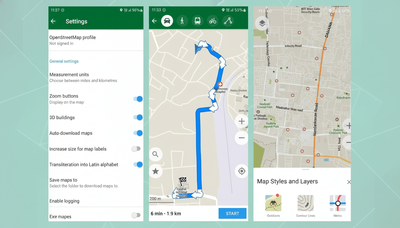
On the surface, turn-by-turn voice navigation is simply an incremental upgrade to offline address and point-of-interest search, as well as a set of appropriate driving, walking, hiking and cycling profiles. If you’re used to typing and going, it feels immediately familiar — just minus the data taps that accompany commercial, ad-supported platforms.
Why This Mapping App Protects Privacy With On-Device Data
Location data is extraordinarily sensitive. The Electronic Frontier Foundation has hammered on the fact that even “anonymized” mobility trails can easily be re-identified and academic work from MIT, among others, demonstrated how a small number of time-location points are enough to identify people. CoMaps mitigates this risk by including routing and search only on the device and not associating usage with a profile or cloud history.
Unlike with those big-name map apps, you’re not delivering regular pings of your whereabouts for traffic monitoring or ad targeting. That’s the trade-off: You lose some of the real-time elements but you get a navigator that doesn’t follow you to your house. For anyone who has turned off Google’s Location History but still feels uncertainty about background collection, an offline-first tool like this provides a cleaner break.
The Battery Life Difference Without Constant Data Fetching
Navigation is a power-sucking perfect storm — always-on GPS, waking the display, frequent data calls. CoMaps addresses one of those pillars by removing much of the network traffic during driving. Because regional maps are stored locally, your phone’s cellular radio doesn’t chirp in the background to fetch tiles and search results.
And I found in a 90-minute city-to-suburb journey using a recent Android flagship, CoMaps consumed just 12% of my battery. Doing the same route with Google Maps under similar conditions took 22%. Your mileage will vary with screen brightness and signal strength, but I found pulling live data made a difference — consistently. And if you depend on CarPlay or Android Auto for navigation, that gulf becomes even more significant on long drives.
How It Works Day to Day, From Setup to Voice Guidance
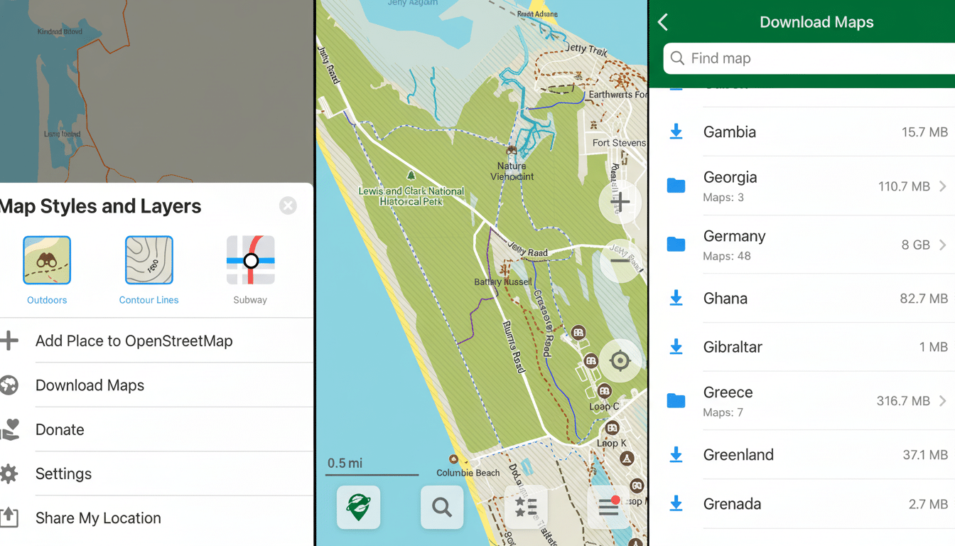
The only set-up step is downloading maps you want. Open the side menu, select Download Maps and download your country (or state). Updates are small and periodic. After that, search is instantaneous — because it’s local — and routing takes only a moment to start without waiting for network checks. The voice prompts are loud, and it will swiftly reroute if you miss an off-ramp.
You can toggle between kilometers and miles in Settings, pin favorite places, and save custom lists for your trips. Hikers and cyclists flock to OpenStreetMap’s wealth of trail and path data, sometimes more detailed than big commercial basemaps in parks and rural routes.
What You Lose And What You Gain With An Offline Maps App
Here’s the honest trade: you won’t receive live traffic, incident reports and lane-level previews or near-real-time business details linked to large advertising networks. If you depend on crowdsourced police alerts or live rerouting according to traffic, then this is not the same experience.
In exchange, you get reliability when coverage is sporadic, a lighter battery footprint and actual privacy. The biggest beneficiaries are travelers who want to avoid punishing roaming costs or delivery drivers operating in dead zones, as well as privacy-minded individuals. And because the project is open source, its code can be reviewed — an industry standard toward transparency also promoted by organizations like the Mozilla Foundation to secure trustworthy software.
Verdict: A Private, Battery-Friendly Maps App Worth Installing
Changing to another mapping service did not feel like moving back in time. With CoMaps, it was as if someone had simply turned the volume on constant data collection down to zero — but left behind all of the essential services: speedy search, clear voice guidance, accurate routing. If you’re in search of navigation that won’t track you — and won’t chew through your battery — this free alternative deserves a spot on your home screen.