A San Francisco startup is claiming it can track anything — a drone, a semi truck, even a robocar — with an inch of accuracy, and investors are buying in to the tune of $35 million in Series C money led by Khosla Ventures as another vote for centimeter‑class positioning that appears to be breaking out from its surveying roots and headed for primetime in autonomy and logistics. The round, which values the company post‑money at $230 million, accelerates a build‑out of its correction network and further pushes its software deep into vehicles and machines that move.
Point One’s pitch is simple: location precise enough that lane‑level maneuvers, curbside stops, loading dock alignments, and drone corridors are no longer a risky business. The company combines augmented GNSS, computer vision, and sensor fusion technology into a developer API used by automakers, delivery fleets, robotics companies, and even makers of wearables and power tools.
How the System Achieves Centimeter Accuracy Outdoors
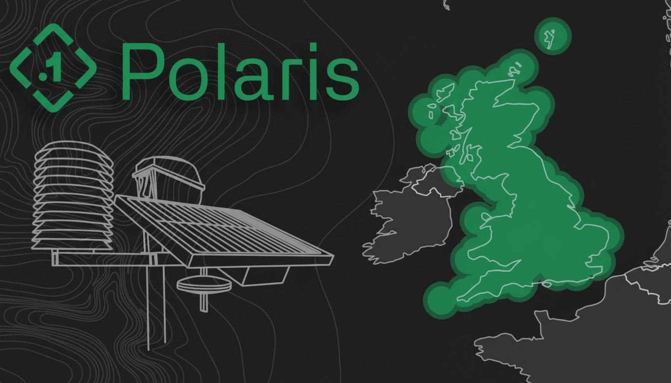
At the heart of everything is Polaris, Point One’s real‑time kinematic (RTK) network. RTK enhances raw satellite navigation data by using correction data transferred from a network of ground stations to a vehicle or mobile device. Since modern RTK is mitigating signal errors in real time, it frequently achieves 1–3 cm accuracy even on open‑sky periodic error applications, a level of performance that has been well recognized by geodesy agencies and the surveying community.
For that level of fidelity, Point One’s base stations — lunchbox‑sized units situated in secured locations, such as telecom facilities — need to be located within about 40 kilometers of the vehicle. That explains the company’s efforts to densify coverage across North America, Europe, and Asia. The cloud service fuses multi‑constellation GNSS data with inertial sensors and visual odometry so trucks, robotaxis, and drones can maintain trust in urban canyons, on flyovers, and during short satellite losses.
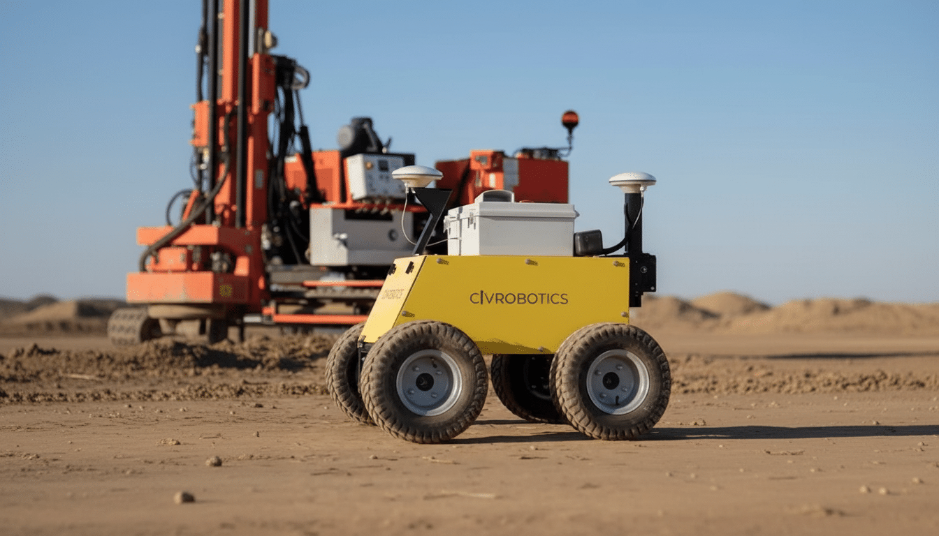
At the customer site, there’s none of the truckloads full of casing gear and bottomhole sensors that Schlumberger has to haul around with its truck fleet — ones that are getting more than a bit long in the tooth but which also show no sign of becoming extinct.
Most late‑model vehicles have all the necessary sensors onboard already, allowing customers to consume Polaris as a “software product.”
For equipment that wasn’t ever born with the correct silicon — think farm machinery, turf care, or first‑responder gear — Point One has a retrofit chipset for centimeter‑grade location.
From robotaxis to farm fields: applications across industries
The company was born into automotive at the height of self‑driving euphoria and is still marooned there. Its software enables autonomous driving and infotainment “orders of magnitude superior to before,” for an EV maker, Holden said, shipping in more than 150,000 vehicles. Contracts also cover some of the most well‑known mowing and turf care companies in the world, a global motorcycle brand, as well as a distribution company that uses about 300,000 last‑mile delivery trucks.
The market for those customers is a diverse one. Robotaxis require lane‑level certainty to pull off unsignaled merges and turns. Drones need to geofence correctly if they are to satisfy regulators and stay out of no‑fly zones. Delivery trucks get precise curb‑approach and dock alignment, reducing time at every stop. Agricultural equipment enjoys repeatable pass‑to‑pass accuracy that reduces overlap and inputs, a mature RTK use case now adapting from fields to city streets.
Since a 2021 inflection point, the number of manufacturers using Point One’s platform has grown about tenfold, covering automotive, robotics, industrial, and wearables. The throughline: self‑driving features and high‑throughput operations require location information that isn’t just “good enough,” but also verifiable and consistent across fleets.
And yes, building out high‑density coverage is next
Coverage density is a gating factor for centimeter accuracy. Point One is focusing on stations across the U.S. Midwest — where agriculture, long‑haul freight, and middle‑mile logistics converge — as well as in dense East Coast markets, while it continues to sprawl through Europe and Asia. The company is on the verge of hitting its target density in a number of regions and has more stations planned to fill in gaps.
Continuity from outdoors to indoors is the next frontier. Today, cars can go from street driving to parking structures and maintain perfect position‑and‑orientation accuracy, but long‑term indoor operation is still an issue. Point One is working to expand its fusion stack for warehouses and factories, so that mobile robots and industrial vehicles can localize as confidently inside as out — a key linchpin in truly ubiquitous location.
Why centimeter‑level positioning matters right now
Centimeter‑level positioning is part of larger industry trends. Regulators are raising expectations around drone tracking and airspace integration, while automakers keep churning out more advanced driver‑assistance features. As e‑commerce volumes soar, logistics providers are maximizing every meter of movement. In such an environment, precise and persistent location data becomes a safety factor, a compliance tool, and a cost lever all in one.
There are plenty of existing precise‑positioning players and new entrants in a crowded competitive landscape, including established surveying incumbents and software‑first startups. The differentiation point of Point One is the density of coverage, sensor‑fusion stack quality, and the efficiency with which one can integrate it via its API. For those who operate fleets, and for original equipment manufacturers, the true litmus will be reliability at scale (read: not crashing en masse) and working in the messy edge cases that define real roads or skies.
What the new Series C funding round will fuel
Series C will further fund additional Polaris stations, enhancements to developer tooling, and increased support for retrofittable hardware, as well as R&D for long‑term indoor navigation. With a $230 million market value and an expanding book of production programs, Point One is positioning itself as the utility supplier for accurate location — a layer that may well become just as essential to mobility as maps and connectivity already are.