


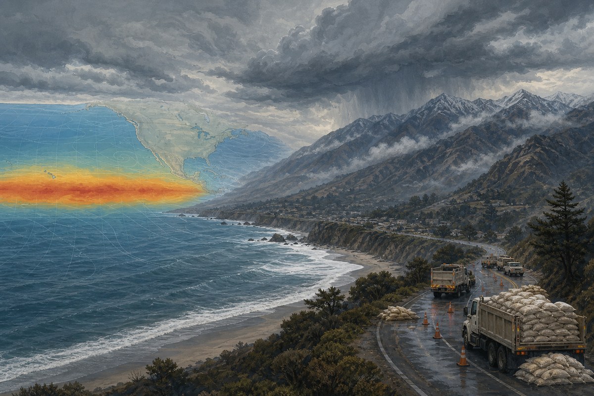
California Gov. Gavin Newsom has proclaimed a statewide emergency as the state prepares for a strengthening El Niño that federal forecasters say is likely to be very strong by fall and winter. The action, announced Sept. 21, is intended to speed preparations for possible heavy rain, flooding, landslides, debris flows and coastal flooding before the core winter storm season.
The emergency proclamation directs state agencies to ready flood-fighting supplies and equipment, transportation resources and support for local work to reduce flood-related risks. It is a concrete response to a seasonal forecast, not a prediction that every part of California will experience damaging storms or an unusually wet winter.
Federal forecast points to a strong event
On Sept. 10, the NOAA Climate Prediction Center’s ENSO Diagnostic Discussion said El Niño had strengthened and that the tropical Pacific Ocean and atmosphere were showing the coupled changes that define the climate pattern. NOAA assigned a greater than 90% chance of a very strong El Niño during Northern Hemisphere fall and winter 2026-27.
The outlook is based on observed conditions and a synthesis of climate models, rather than a single forecast model. NOAA reported that August sea-surface temperatures in the Niño-3.4 region of the central equatorial Pacific were 1.8 degrees Celsius above average. Anomalies were higher farther east: 2.5 degrees Celsius in Niño-3 and 3.4 degrees Celsius in Niño-1+2. Changes in tropical winds, clouds and rainfall indicated that the atmosphere was responding to the unusually warm water.
NOAA also placed a 75% chance on the October-through-December three-month Relative Oceanic Niño Index, or RONI, reaching at least 2.5 degrees Celsius. Under that specified measure, NOAA said such a value would exceed the strength of prior El Niño events since 1950. That is a probability for a defined index and time window, not a declaration that the event has already become the strongest in the historical record.
Several intensity numbers circulating in coverage should not be used interchangeably. The Guardian reported a 3.05-degree-Celsius anomaly using a 1991-2020 reference period. NOAA’s 1.8-degree August Niño-3.4 reading, its regional Niño measurements and its RONI threshold refer to different areas, baselines or averaging periods. A larger number under one system does not by itself establish a more intense event than a lower number under another.
What El Niño can—and cannot—say about California’s winter
El Niño is the warm phase of the El Niño-Southern Oscillation, a recurring tropical Pacific pattern that can alter atmospheric circulation and shift weather odds far from the ocean where it begins. NASA explains that El Niño events arise irregularly, typically every two to seven years, and can influence weather globally through those ocean-atmosphere connections.
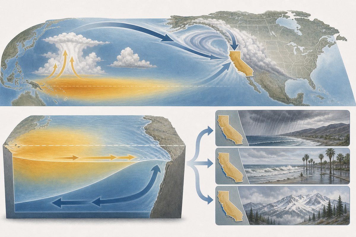
For California, those changed odds can be important for planning. Agencies must consider risks to communities below recent burn scars, where intense rain can trigger debris flows; roads and rail corridors vulnerable to flooding or slope failures; and low-lying coastal areas exposed to high water and surf. The state said its preparations would include staging resources and assisting local governments with flood, landslide and debris-flow readiness. The Los Angeles Times also reported that local officials were beginning preparations for possible severe rain and coastal impacts.
But a strong tropical Pacific signal cannot determine where individual storms will form, whether they will strike California, or how much rain or snow they will deliver. The U.S. Geological Survey’s regional overview notes that precipitation and snowfall responses across the Southwest have varied among El Niño winters. Atmospheric rivers—narrow corridors carrying large amounts of water vapor—are particularly consequential for Western storms and limit the ability to forecast local impacts months in advance.
That uncertainty is why the declaration is better understood as risk management than as a forecast of inevitable disaster. Seasonal climate outlooks can raise the likelihood of broad patterns; they cannot attribute a future flood, coastal erosion event, power outage or health effect to El Niño in advance. Nor would a quieter season in one region necessarily mean the broader climate forecast was wrong, because local weather remains shaped by shorter-term atmospheric variability.
Preparedness begins before the peak season
California’s action came 11 days after NOAA issued its advisory, creating a short timeline between the updated climate outlook and state-level preparations. The state characterized the developing event as potentially record-setting, but NOAA’s formal language is more specific: it describes a high probability of a very strong event and a 75% chance of surpassing previous events under its October-December RONI benchmark.
For residents and local agencies, the immediate practical implication is preparation rather than certainty about outcomes. Forecast updates from NOAA and the National Weather Service will be more useful for decisions about particular storms as winter approaches, when they can incorporate the evolving position, timing and intensity of weather systems. California’s proclamation puts equipment and planning in motion while those details remain unresolved.