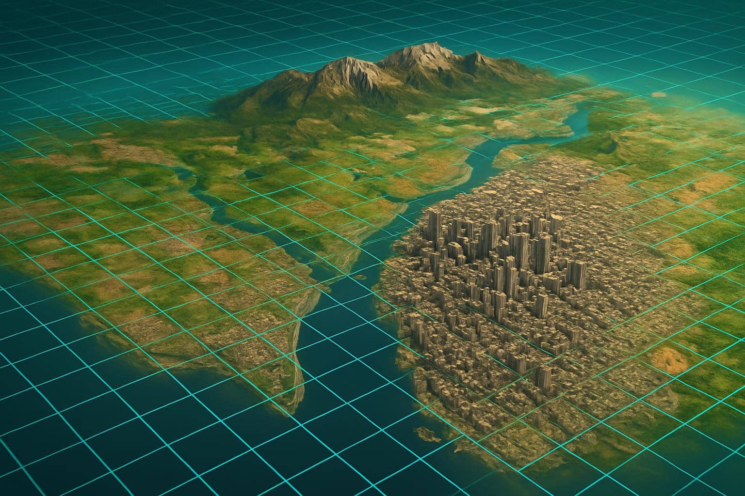
A new generation of 3-D mapping technology is driving efforts to create fully explorable, live-action digital copies of the world — all the way from the natural scenery down to the dusty old streets, though with certain exceptions, including anything the Russians or the Chinese want to keep under wraps. Consider it a digital living twin of Earth — one that gives you more than just where you are, but also what’s around you, how things are changing, or even what’s likely to happen next.
This change is significant; This change matters, because coordinates aren’t enough anymore. First responders require block-by-block mapping of flood extent, minute by minute. City planners crave centimeter-accurate models of bridges and tunnels. Farmers aim for plant-by-plant decisions. The newly receptive stack of geospatial tech can answer those questions at speed and scale, even when GPS fails or goes stale.
What “beyond GPS” actually means
GPS and other global navigation satellite systems are great for global positioning, but they weren’t created to give us a real-time, 3D sense of a place. Signals fade in to urban canyons, tunnels and thick forests; jamming and spoofing are growing concerns; and consumer-grade accuracy in some conditions is measured in several meters. Those vulnerabilities have been cataloged in much greater detail in reports from the Royal Academy of Engineering and the U.S. National Academies.
Next-gen mapmaking bridges the divide by integrating geometry, semantics, and time, into a single common environment. You receive not merely latitude and longitude but a rich three-dimensional model of buildings, roads, terrain, vegetation and infrastructure — keyed at every point to dimensional coordinates and supplemented by other data types like material, condition and risk. It is the difference between a blue dot on a flat map and a living scene inhabitable, queryable, simulatable, trustable.
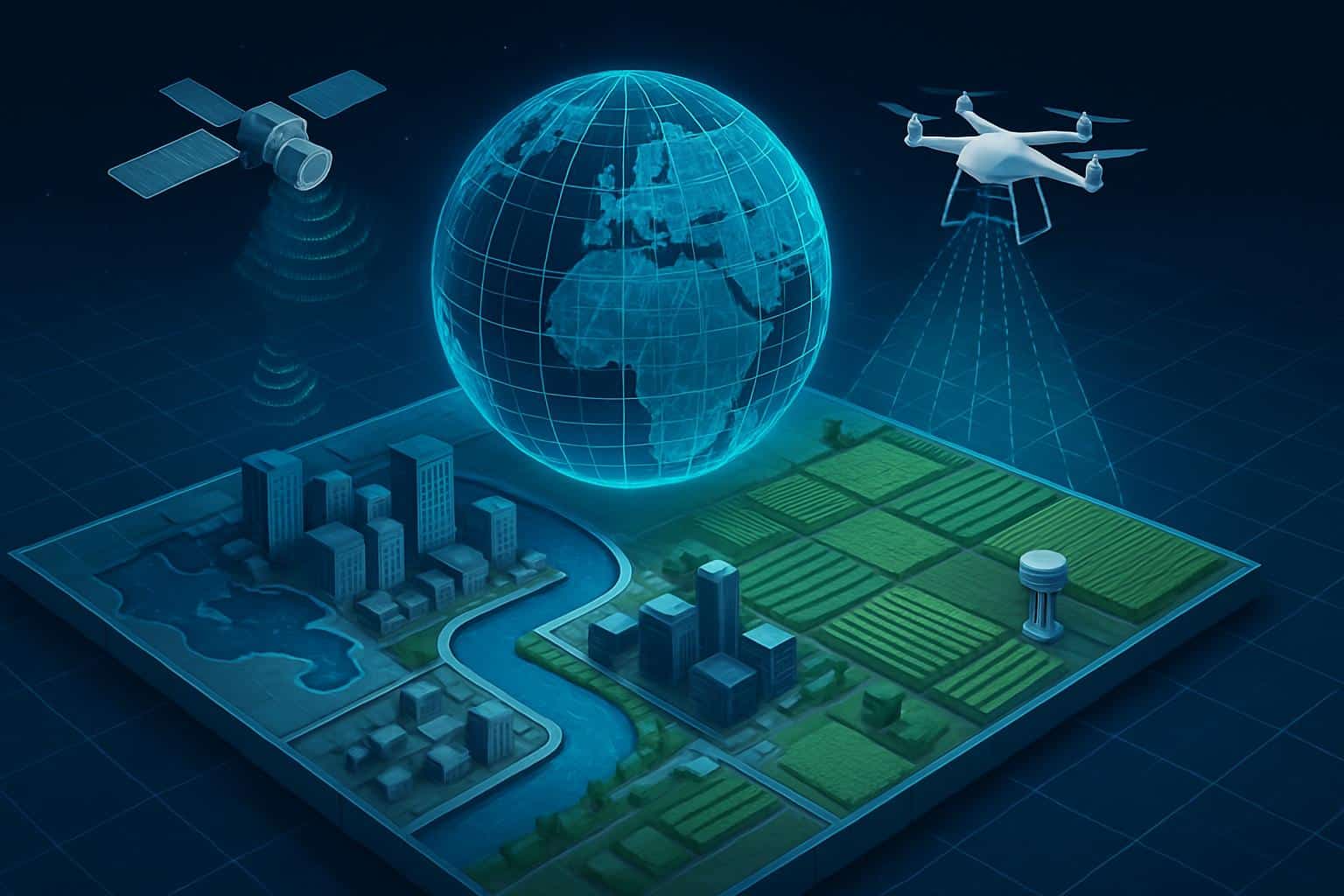
The tech stack behind a living planet
On top of that stack lies SAR — synthetic aperture radar — which can see through clouds and darkness. Commercial constellations run by companies like ICEYE and Capella Space provide revisit rates in hours, not days, allowing disaster monitoring at any time. Interferometric SAR (InSAR) also has an additional skill, which is the ability to monitor the movement of the ground in tiny increments, down to the scale of millimeters — something space agencies, including ESA and USGS, use to track subsidence and earthquakes.
Visual image layers fine detail on fine detail. High-resolution satellites from companies like Maxar can make out features as small as about 30 centimeters, while vast fleets like Planet’s produce daily, medium-resolution images that cover the entire earth. From the skies above the city, crewed aircraft and drones offer LiDAR point clouds with an accuracy to the vertical of roughly 5–10 centimeters making surgical maps of powerlines, tree canopies, and construction sites.
On the ground, vehicle-mounted cameras and sensors, which integrate simultaneous localization and mapping (SLAM) and inertial navigation technology, measure curbs, lane markings and building façades where GNSS is less accurate. These AI models then perform change detection, along with standard computer vision tasks like segmentation and object extraction (ie: turning raw pixels and points into labeled, usable features: “this is a new barricade,” “that crane moved,” “these lanes shifted”).
The output is streamed into standard formats — such as the Open Geospatial Consortium’s 3D Tiles — so that maps become living data services rather than static files. With that you can have incremental updates: rather than replacing an entire city model, systems publish only what has changed, which is crucial to real-time performance at planetary scale.
Digital twin to operational decisions
Emergency management is the most obvious example. During storms when optical imagery is blind, SAR-generated flood maps could be attained, which would help to evacuate and protect property. Research programs at NOAA and the USGS have demonstrated how combining radar, river gauges and balance models can produce near-real-time inundation layers that identify which blocks and basements are endangered.
In the wake of earthquakes, InSAR uncovers patterns of ground displacement within hours, allowing authorities to prioritize inspections of bridges or pipelines or rail. During wildfires, thermal and multispectral data can sketch out active fire lines and spot fires that might not be visible from the ground, helping to create better containment strategies and ensure firefighter safety.
Industry is moving fast, too. Drone LiDAR overlay on design models aids construction teams in progress verification and early deviation identification, further reducing rework. Vegetation height models are also combined with wind forecasts to forecast line strikes. In agriculture, satellites and on-farm sensors enable variable-rate seeding and irrigation, increasing yields and lowering inputs, according to research from the Food and Agriculture Organization.
Resilience when signals fade
Since these systems are not dependent entirely on satellite positioning, they does a good job where you are not allowed to use GPS. Urban-canyon vehicles can also localize against the 3D map itself with the aid of visual landmarks and LiDAR, a popular technique in autonomous driving. IMUs, UWB beacons, and vision-based mapping remain accurate even in the absence of sky views in mines, tunnels, and warehouses.
It also helps to thwart active interference. When GNSS can be jammed or spoofed, multi-sensor localization and scene understanding ensure that critical operations—ports, airports, emergency services—stay on track. Decades-old defense and civil-aviation safety studies have been calling for the same kind of multi-layered PNT for years.
Standards, governance, and trust
A planet view raises tough questions. Who determines cadence to upgrade sensitive sites? How is privacy preserved for people and license plates in our street-level imagery? So at one end standards bodies like OGC and ISO/TC 211 work on open formats and metadata for provenance, while at the other privacy regulators demand on-device redaction of sensitive detail and strict access controls. And without verifiable lineage and bias checks in AI labeling, the most gorgeous 3D model is just another bad map.
What’s next
Anticipate more edge AI occurring on satellites and drones, so that insights are generated in orbit and at the scene, rather than hours later in the cloud. Look for richer semantics —maps that are aware not just of where the road is but of its temporary speed limit, lane closures and the state of the guardrail. And there’s more teamwork to come: space agencies such as NASA, ESA and ISRO are co-ordinating missions like NISAR to provide common, global baselines for commercial entities to add value to.
GPS isn’t going anywhere; it is the foundational framework for worldwide timing and location. But the future of navigation and situational awareness is multimodal and 3D, dynamically refreshed and context-aware. We’re transitioning from dots on a screen to a living model of Earth — and it will transform how we plan, respond, build and move for decades to come.