Apple has shut down the automated Flyover city tour feature in Apple Maps, a service that automatically flew iOS and macOS device users across areas of interest, embedded in 3D urban environments generated using flyby data with an adjustable virtual camera. The move also appears to end public access to footage of specific locations filmed by low-flying planes — yet another one of Apple’s weird-flavor features lost today in relevant terms but left vague about why its main functionality was unceremoniously axed.
What Apple Took Away and What Will Be Left
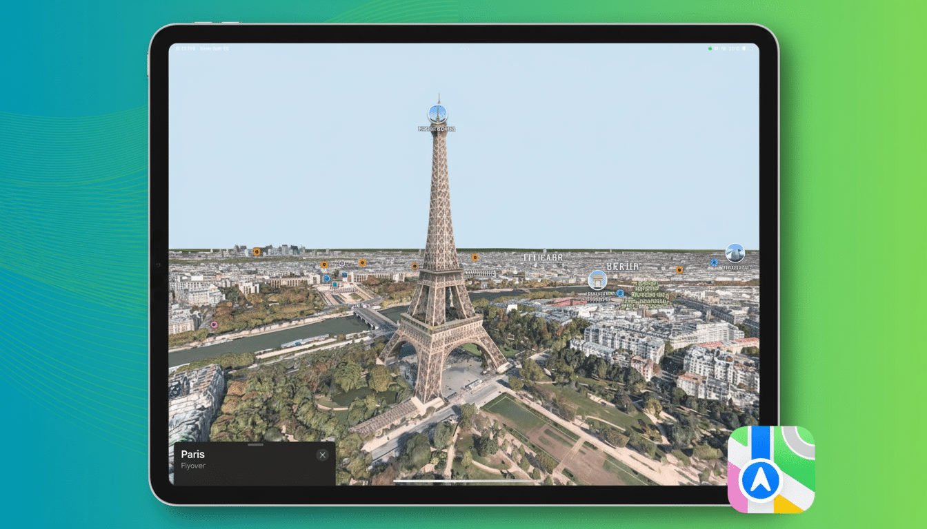
Flyover itself isn’t gone. You can still tilt into 3D and orbit buildings and pan across cities in Photorealistic Great Detail Mode. Gone is the automated path that previously wound through key sights in a few world cities, complete with camera moves, callouts and occasional animations.
- What Apple Took Away and What Will Be Left
- A quiet sunset for a niche Maps Flyover feature
- Why Apple chose to retire the automated Flyover tours
- Alternatives for virtual exploration beyond city tours
- What it means for users and developers after the change
- The bottom line on Apple Maps ending Flyover city tours
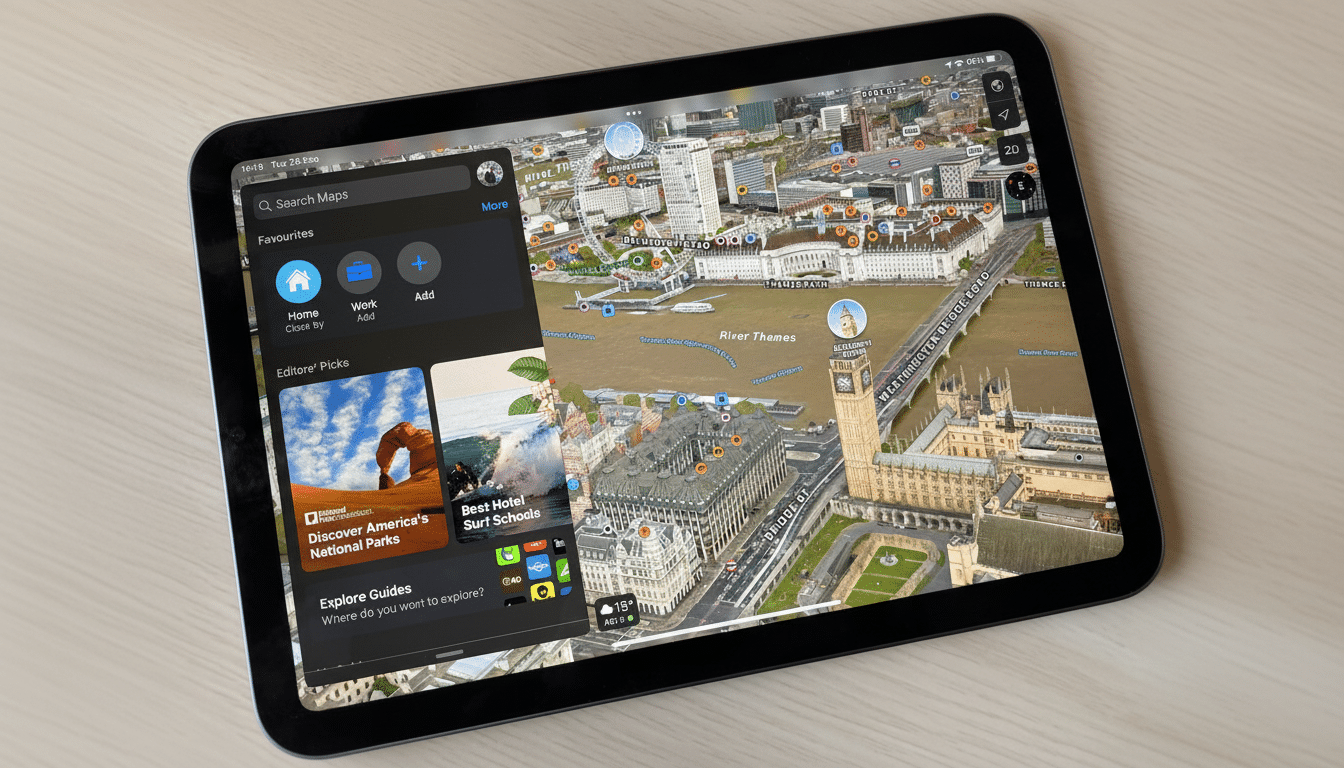
Those trips were mini travel trailers. In London, the route included hops near Buckingham Palace, Westminster Abbey, Elizabeth Tower (which holds Big Ben), Tower Bridge and even a quick stop next to the London Eye — with the wheel turning in a tiny animation. There were similar sequences for New York’s Statue of Liberty and Times Square, or San Francisco’s Golden Gate Bridge and Alcatraz.
A quiet sunset for a niche Maps Flyover feature
The change became evident via Apple’s community forums, after which it started being reported on by Apple-focused outlets that had observed documentation changes referencing the removal of city tours. Apple did not even make a formal announcement, suggesting that the company saw this deprecation as an unimportant adjustment to legacy code rather than any kind of strategic change.
Apple has spent years building up the 3D coverage of Flyover, an investment that hasn’t stopped. Apple told The Verge that Flyover covered about 350 cities at the time, and new additions like Plzeň in the Czech Republic, Stavanger in Norway or Lucerne in Switzerland are a sign that the imagery pipeline isn’t going to sleep. It’s the layer that curates tours, not the data itself, that is being retired.
Why Apple chose to retire the automated Flyover tours
Engagement is the simplest explanation. Apple doesn’t often disclose usage numbers, but the fact that there was no fanfare about the feature suggests tours weren’t much used. In mapping products, features that don’t meaningfully contribute to everyday navigation or discovery can be trimmed in favor of those that do.
There’s also a maintenance tax. Tours needed editorial curation, localization and updating as skylines changed. Each new point of interest, transit hub or restricted airspace could require reworking camera paths and callouts. Hand-tuned tours are more expensive to maintain at global scale than an algorithmic equivalent.
Strategically, Apple Maps is casting off into live, immersive utilities — Look Around street-level imagery, offline maps and lane guidance; electric-vehicle routing, real-time transit information and a “detailed city” experience with improved road geometry and landmark models. Game analysts regularly report that these types of features increase daily retention rates better than spectacle-based exhibits.
Alternatives for virtual exploration beyond city tours
If you relied on tours to see a preview of a place, Flyover’s manual settings continue to present grand aerial vistas while Look Around gives you ground-level exposure in various places.
The company’s editorial Guides provide curated spots from reputable publishers, making it a more usable starting point for planning than any canned fly-through.
Outside of the Apple ecosystem, Google Earth’s Voyager serves storylines rich in geography and narrative; Google Maps’ Immersive View combines aerial flyovers with street imagery for pre-emptive journeys around certain locations. These options highlight a larger trend in the field towards getting people to play/explore versus just watching pre-baked reels.
What it means for users and developers after the change
For the majority of people, the change is more about losing a cool party trick than a core tool. The navigation, search and discovery workflows on a day-to-day basis remain unchanged. Teachers and tourism promoters who once relied on tours to establish context might instead transition to customized experiences using MapKit, mashing up Flyover’s three-dimensional world with overlays, annotations and links to Look Around.
If you have saved tours, they will meanwhile launch standard map views. To see the change for yourself, look up a supported city, switch it to satellite and then 3D mode, and enter Flyover — you can still pan and orbit around the area in question, but the “Start Tour” control is gone.
The bottom line on Apple Maps ending Flyover city tours
As it does, Apple will also be cutting a little-used layer off that tree, while continuing to plow tons of capital into the 3D foundation upon which it rests. The move leans toward features that assist you in getting from place to place, rather than just looking around — a practical choice based on where mapping competition and user behavior has gone.